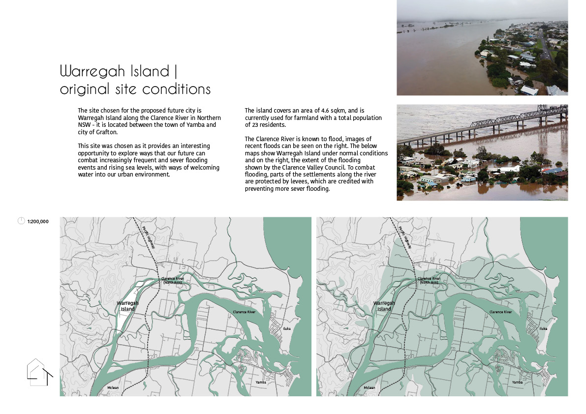
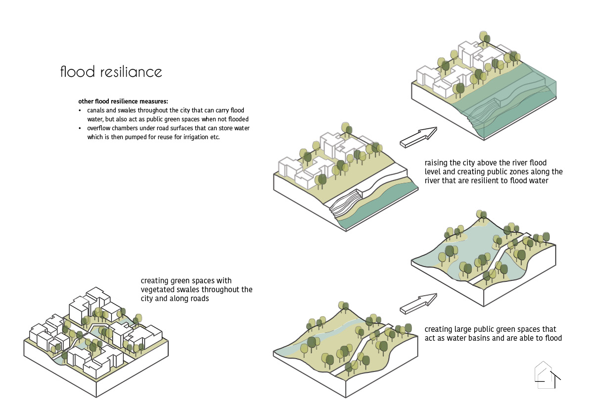
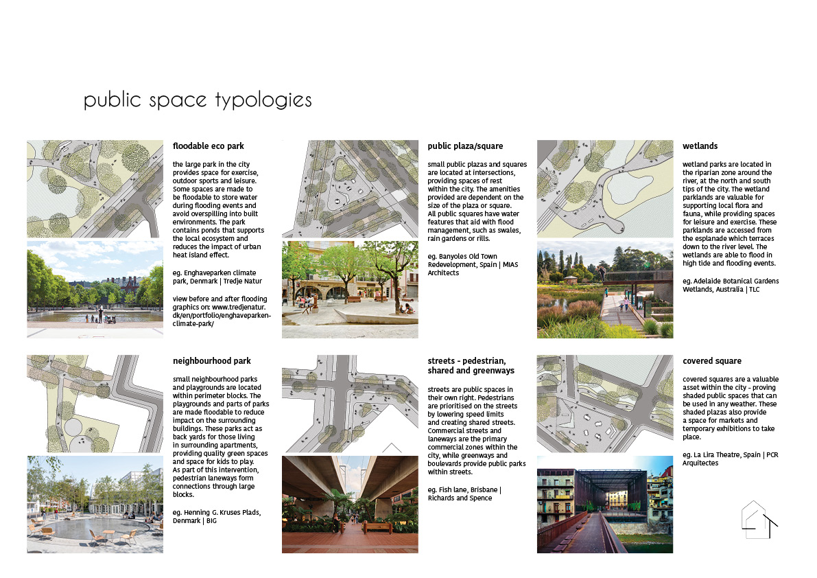
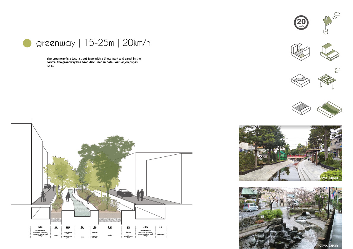
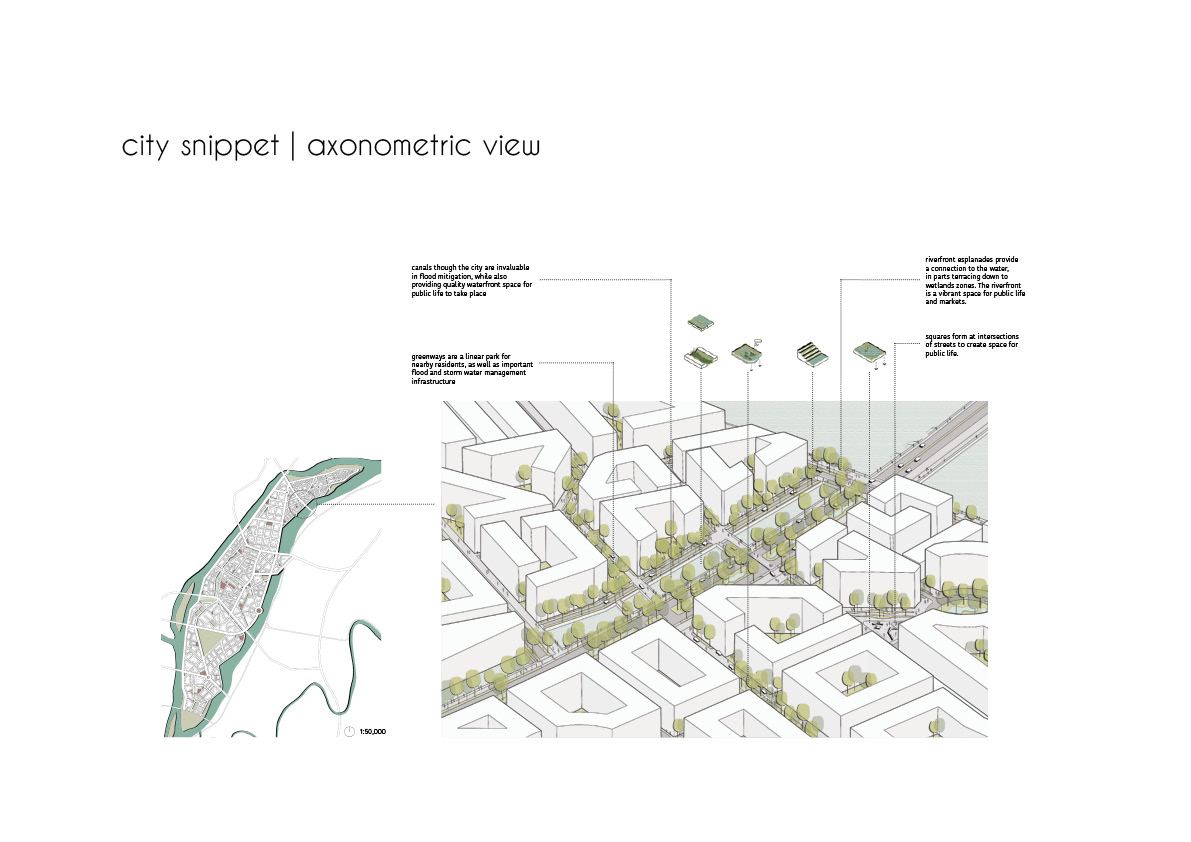
The proposal for a new city on Warregah Island, NSW, aims to provide insight into how future cities can be built to tackle increasingly frequent and severe flooding events, rising sea levels and storms. To avoid large scale devastation from floods, flood resilience strategies are employed to create ‘floodable’ public spaces that lessen the impact on the city and welcome water into our urban environment.
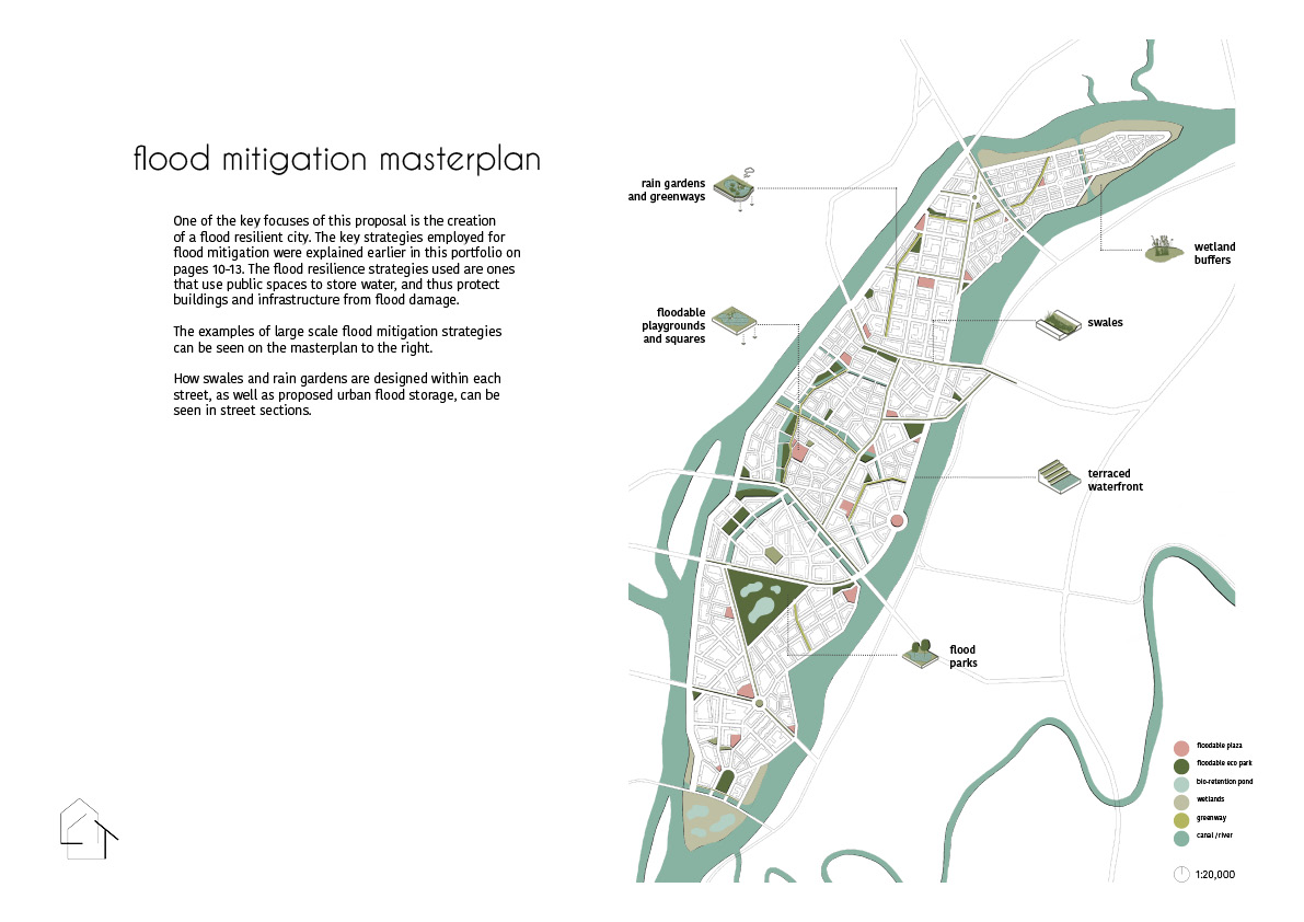
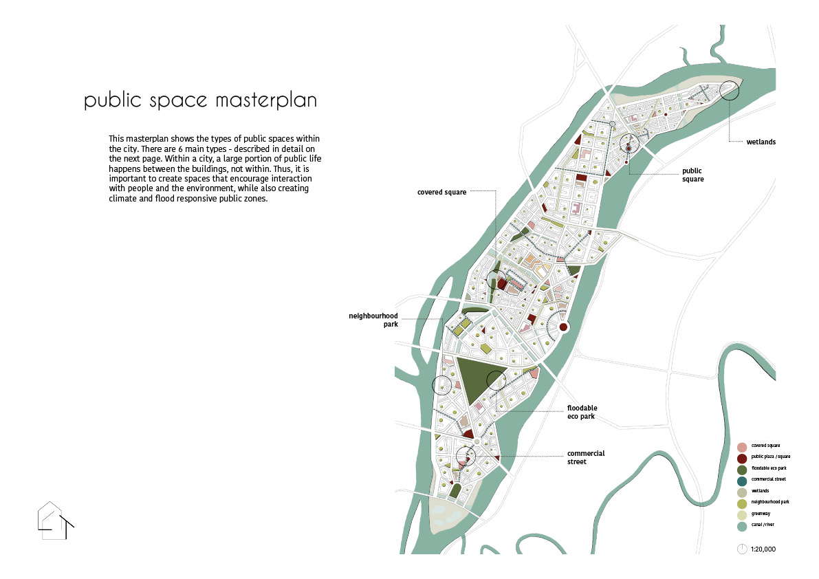
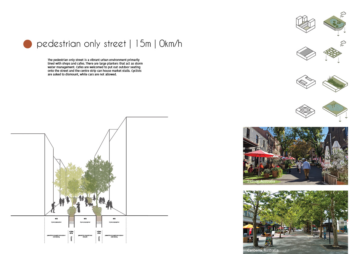
The city has a dense network of parks and vibrant public spaces of different typologies. A large part of the public spaces is designed to be flood resilient, to help store large amounts of flood or storm water. By building ‘floodable’ public spaces that are easy to clean off after a weather event, it provides a safety buffer that avoids large scale devastation. To help with storm water management – the city is designed to be permeable – allowing water to naturally filter through the urban surfaces to ease pressure on the storm water systems.
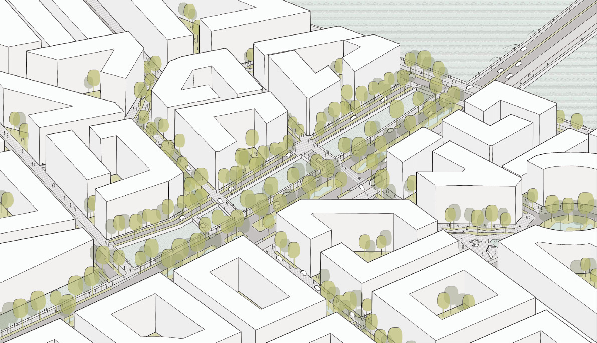
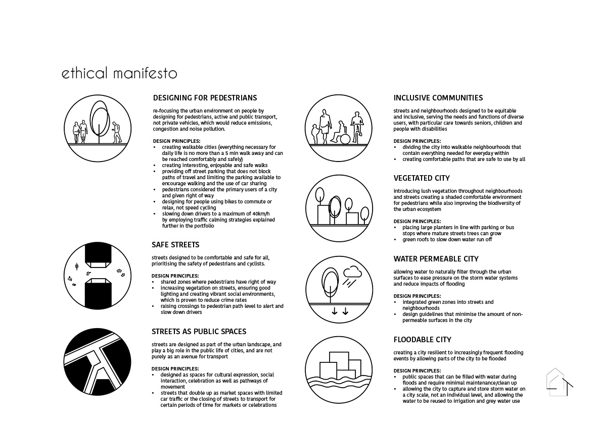
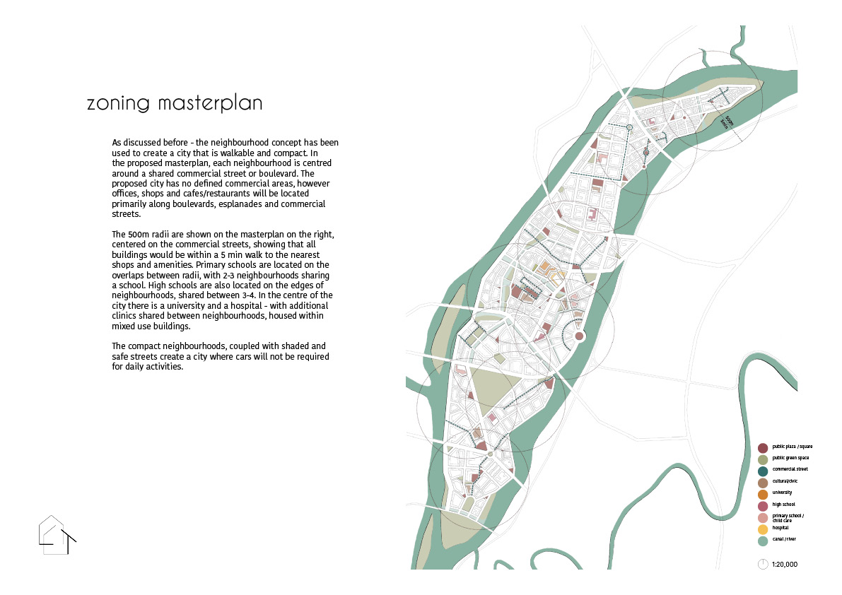
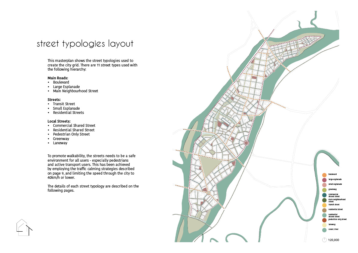
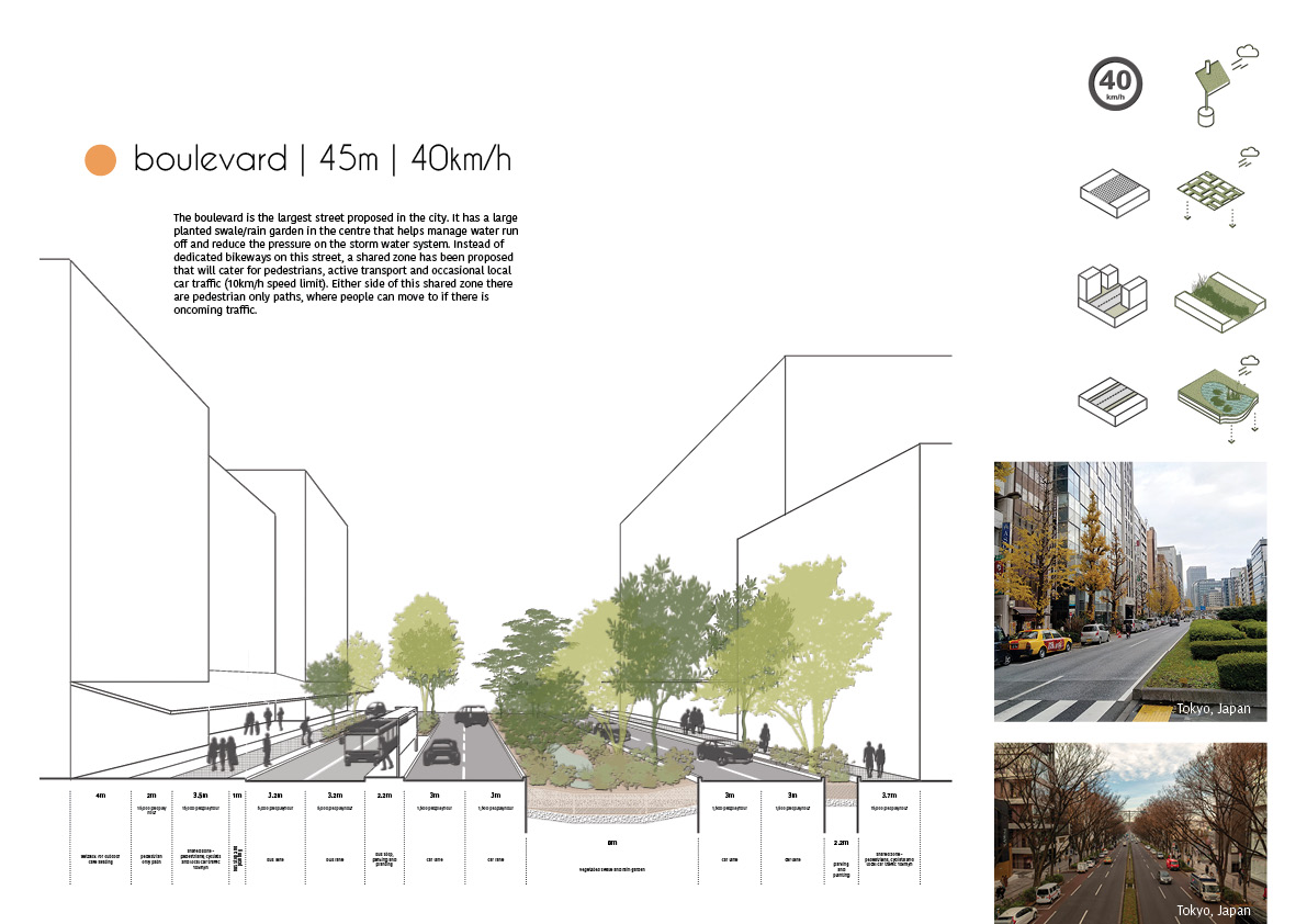
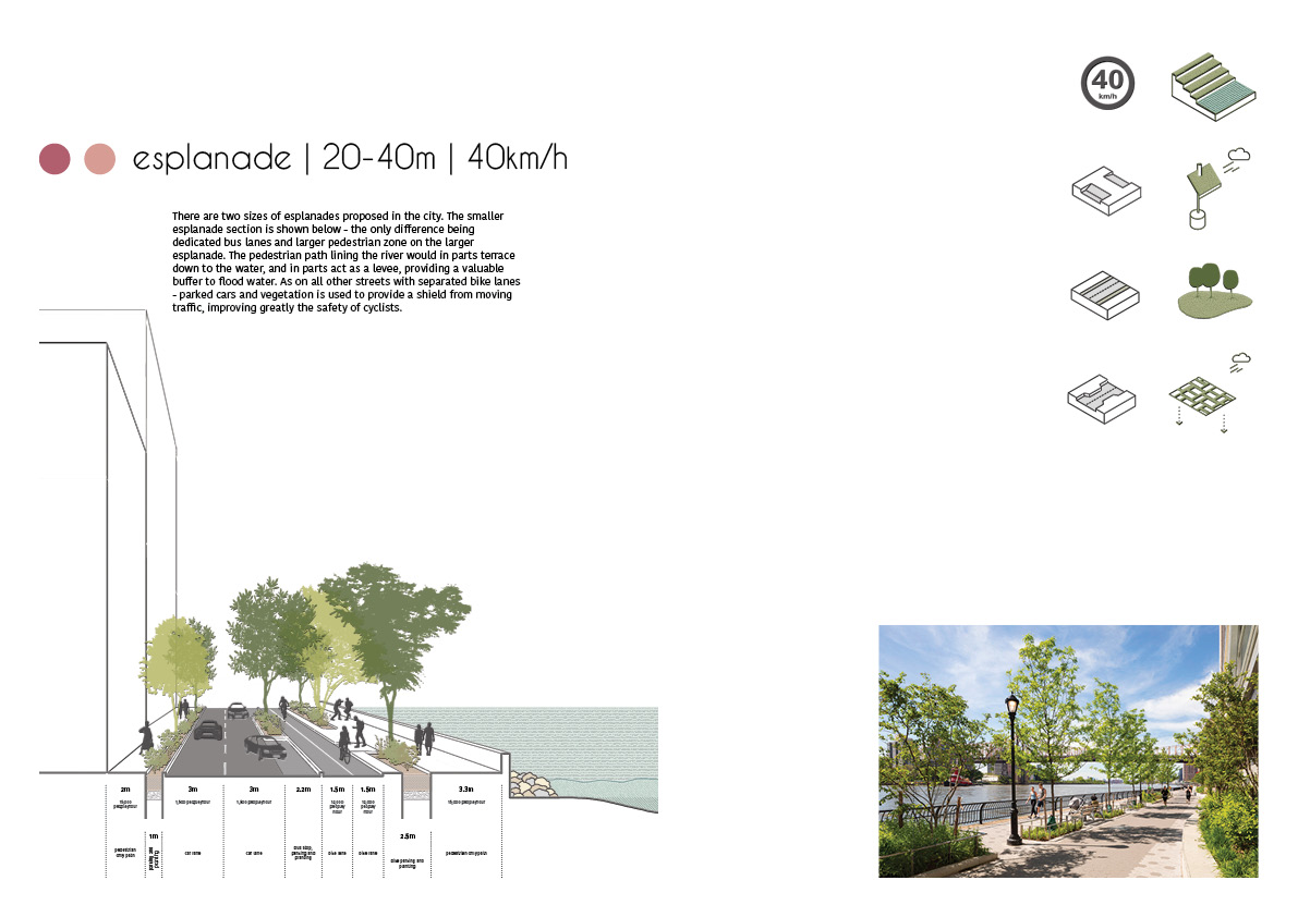
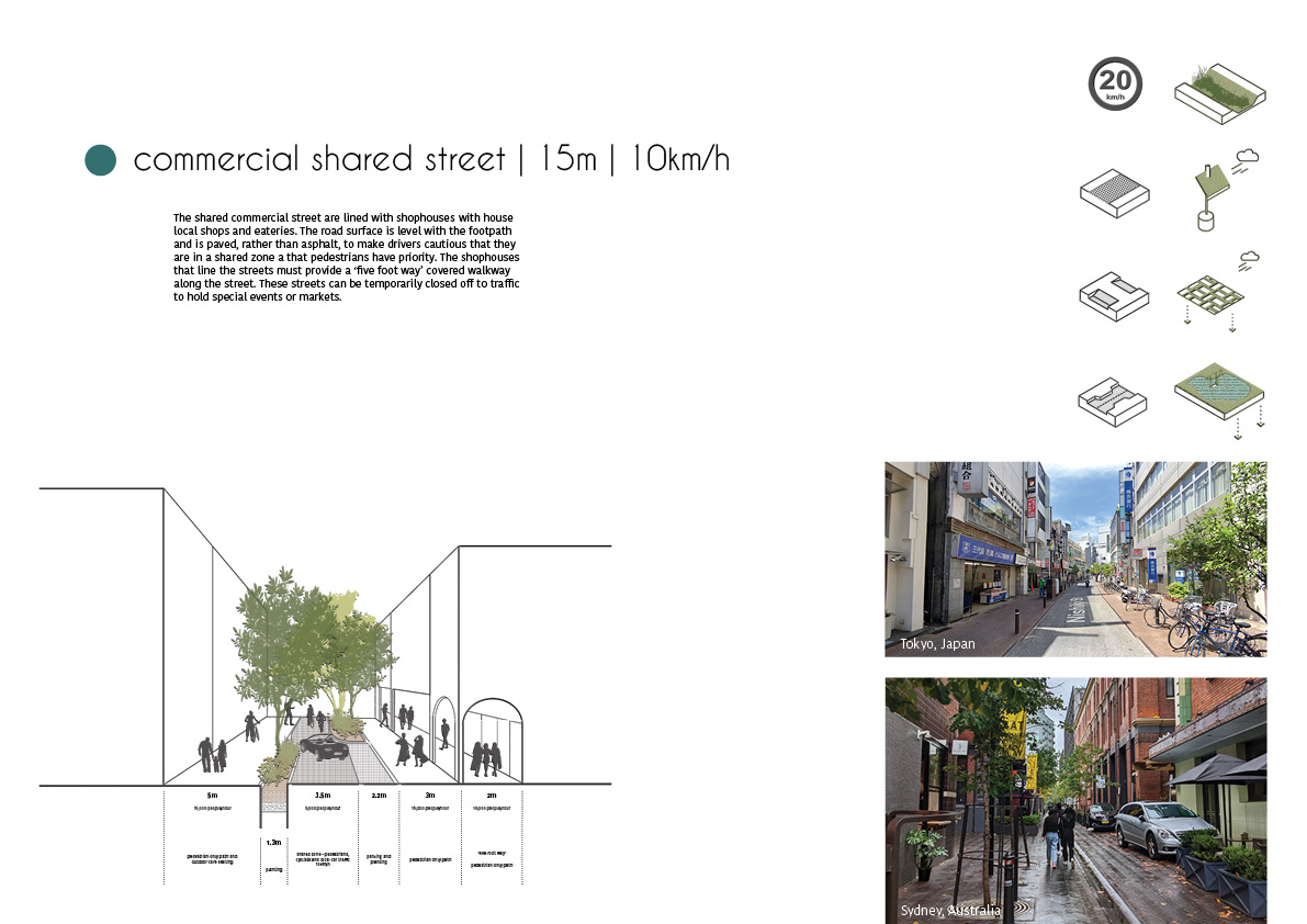
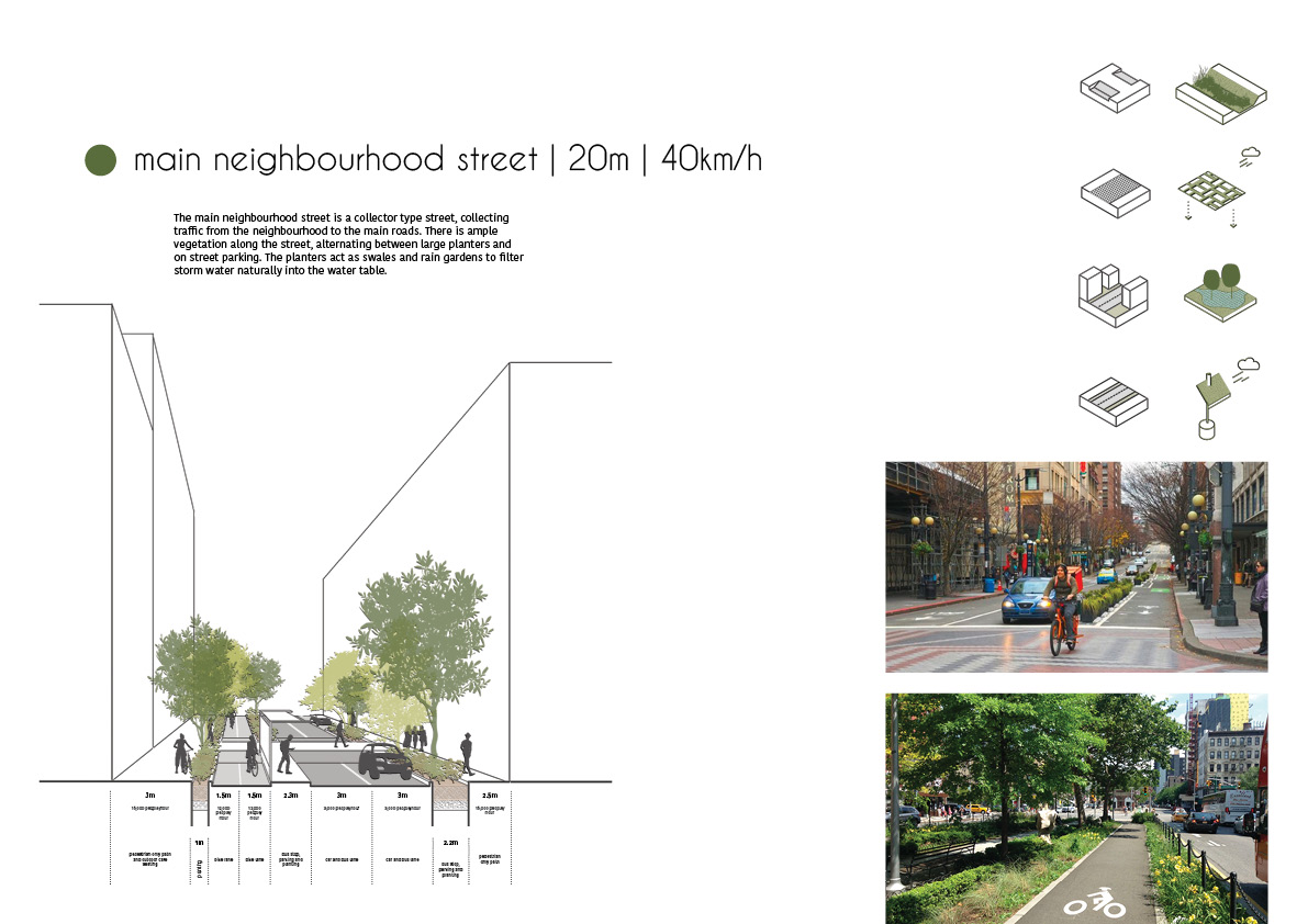
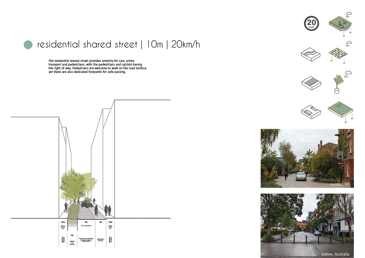
Together with flood resilience, the focus of this proposal is creating a walkable city and re-focusing the urban environment on people. The city is designed around pedestrians, active and public transport, not private vehicles, which reduces emissions, congestion and noise pollution. The streets themselves are designed as part of the urban landscape, and play a big role in the public life of cities, and are not purely as an avenue for transport. Streets are vibrant spaces of cultural expression and social interaction as well as paths of movement. The primary focuses is to create pedestrian friendly environments. However, understanding that cars are still a necessary part of daily life – the city caters for cars without encouraging their use. The city streets designed to be comfortable and safe for all, prioritising pedestrians and cyclists – this is achieved by using traffic calming strategies are proven to calm vehicular traffic, creating safe and welcoming streets.
The city covers 4.6 square kilometers and is divided into 10 walkable neighbourhoods. These compact neighbourhoods (max 400-500m radius), are defined by larger roads around the perimeter and contain everything needed for daily life within a 5 min walk. The neighbourhoods are small enough for all places to be within walking distance of each other and for people to form a community, yet large enough to support a wide range of activities, facilities and businesses. Each neighbourhood has access to basic amenities – a primary school, shops, parks and playgrounds and with buildings and streets configured so that public facilities are within safe pedestrian access.